Google has released a new version of Maps that uses a complicated visual positioning system (VPS) to provide better navigation. VPS was created to circumvent the limitations of the global positioning system (GPS) and is significantly more accurate.
What exactly is the Virtual Positioning System (VPS)?
VPS is the obvious next step after a globally linked network, extensive data, and new cloud storage access. VPS is a hybrid of artificial intelligence (AI) image recognition technology and augmented reality technology that combines symbols on the app’s screen with real-world street photographs.
It combines the live camera with Google’s enormous back-end data to analyse the surroundings, allowing it to more accurately determine a user’s position.
It makes use of augmented reality to provide more information.
Recently, the technique was employed on the Chandrayaan II mission.
- It combines the live camera with Google’s enormous back-end data to analyse the surroundings, allowing it to more accurately determine a user’s position.
- It makes use of augmented reality to provide more information.
- Recently, the technique was employed on the Chandrayaan II mission.
System of Positioning
A positioning system is a device that determines the location of a person or item. To attain pinpoint precision, the technology needs global coverage and pinpoint accuracy.
For example, ‘Google Maps’ is a positioning and navigation system that assists people in determining their actual location as well as a route to their destination. However, the device merely provides a satellite image of the area being navigated.
The Global Positioning System (GPS)
GPS is a satellite navigation system that determines an object’s ground location. It is a utility owned by the United States that offers customers with positioning, navigation, and timing (PNT) services.
It is a network 24 satellite that serves both civilian and military customers. The civilian service is provided to all users on an ongoing, global basis. Military service is open to members of the United States and its allies, as well as designated government entities.
How does it function?
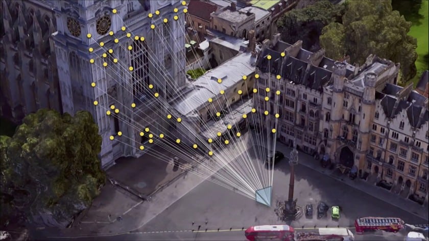
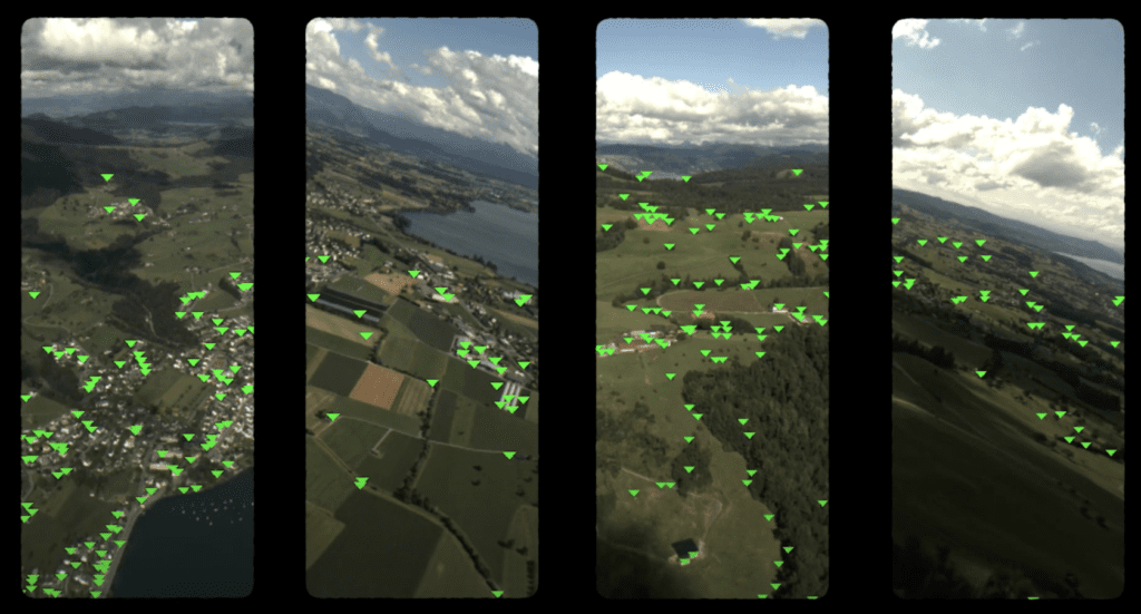
- The Visual Positioning System enables the gadget to realistically locate itself on a map. It creates a 3D world by combining numerous photos of the surrounding surroundings.
- Using GPS triangulation methods, the system analyses several images of the surroundings captured by the phone’s camera to reconstruct the location relative to the environment.
- To utilise the technology, the user must first activate the visual view by tapping a button and then just point the camera where he or she wants to see pertinent information.
- Surroundings will be presented with a Google map overlay.
- There will be arrows heading in the user’s direction, as well as a mini-map at the bottom to remind you where you are going.
- The system can determine interior and outdoor locations using ad hoc visual indicators. Geolocated photographs are scanned to identify distinguishing elements such as signs, buildings, and walls.
You might also be interested in reading, Hydrogel shrinkage broadens nanofabrication possibilities